-
- Books, Local and Social History, Maps
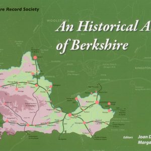
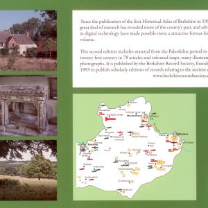
An Historical Atlas of Berkshire, (2nd Edition)
- £20.00
- This new enlarged edition with 74 articles on Berkshire's history from the Palaeolithic to 21st century each accompanied by maps in full colour, and with numerous illustrations. Indispensable to those with Berkshire ancestors. Joan Dils and Margaret Yates, editors (Berkshire Record Society, 2012) Second edition ISBN: 9780 9548 7169 7
- Read more
-
- Berkshire FHS Publications, CDs, Maps
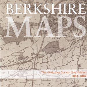
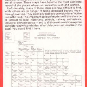
Berkshire Maps, Ordnance Survey Maps, First Edition, 1881-1887 (CD)
- £12.50
- This disc includes all those 6 inch to the mile scale, first edition OS maps of Berkshire, scanned from the set held at Berkshire Record Office compressed to fit on one CD. A total of 51 maps are included, with an index and bookmarks for each map.
- Read more
-
- Berkshire FHS Publications, Maps
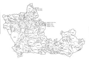
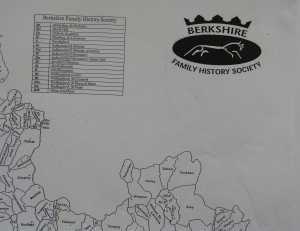
Berkshire Parish Map
- £1.00
- An A3 size map of the old county of Berkshire showing the parish boundaries mid-19th century. At this price you can afford to happily add your own comments and annotations.
- Read more
-
- Maps
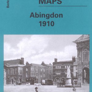
Abingdon, Old Ordnance Survey Map, 1910
- £3.50
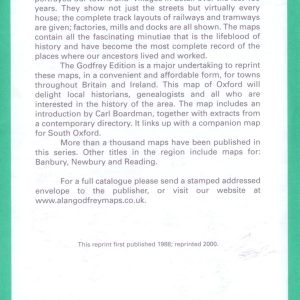
- This map is part of a series of town maps with a scale of about 15 inches to the mile. They show not just the streets but virtually every house, track layouts of railways and tramways, factories, mills and docks.
- Read more
-
- Maps
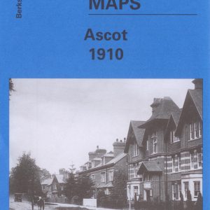
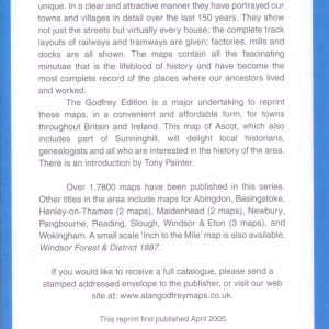
Ascot, Old Ordnance Survey Map, 1910
- £3.50
- This map is part of a series of town maps with a scale of about 15 inches to the mile. They show not just the streets but virtually every house, track layouts of railways and tramways, factories, mills and docks.
- Read more
-
- Out of Stock
- Maps
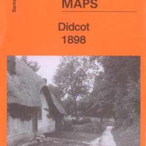
Didcot, Old Ordnance Survey Map, 1898
- £3.50
- Large Scale Town Map approach 152 to the mile.
- Read more
-
-
- Sale!
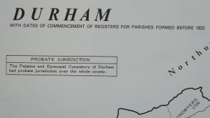
- Maps, Parish Registers - all denominations
Durham Parish Register Map (IHGS)
- Original price was: £4.50.£2.25Current price is: £2.25.
- Read more
-
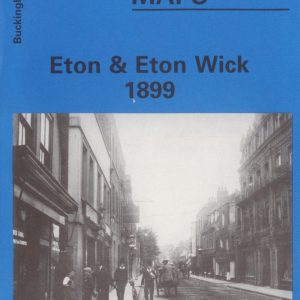
- Maps
Eton & Eton Wick, Old Ordnance Survey Map, 1899
- £3.00
- This map is part of a series of town maps with a scale of about 15 inches to the mile. They show not just the streets but virtually every house, track layouts of railways and tramways, factories, mills and docks.
- Read more
-
- Out of Stock
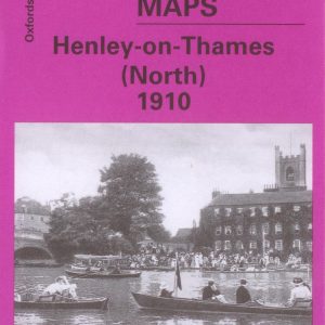
- Maps
Henley-on-Thames (North), Old Ordnance Survey Map 1910
- £3.50
- This map is part of a series of town maps with a scale of about 15 inches to the mile. They show not just the streets but virtually every house, track layouts of railways and tramways, factories, mills and docks.
- Read more
-
-
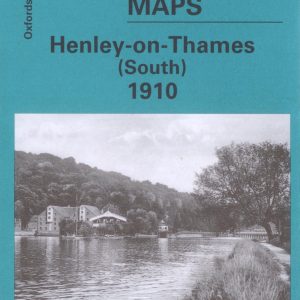
- Maps
Henley-on-Thames (South), Old Ordnance Survey Map 1910
- £3.50
- This map is part of a series of town maps with a scale of about 15 inches to the mile. They show not just the streets but virtually every house, track layouts of railways and tramways, factories, mills and docks.
- Read more
-
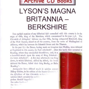
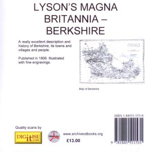
- Books, CDs, Local and Social History, Maps, Photos
Lyson’s Magna Britannia, Berkshire,1806 (CD)
- £13.00
- A facsimile reproduction of the original books with fine engravings - excellent description and history of Berkshire. The work covers general topics on the county and the individual parishes and towns.
- Read more
-
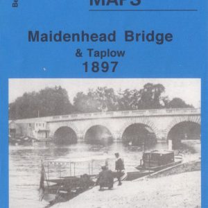
- Maps
Maidenhead Bridge and Taplow, Old Ordnance Survey Map, 1897
- £2.25
- This map is part of a series of town maps with a scale of about 15 inches to the mile. They show not just the streets but virtually every house, track layouts of railways and tramways, factories, mills and docks.
- Read more
-
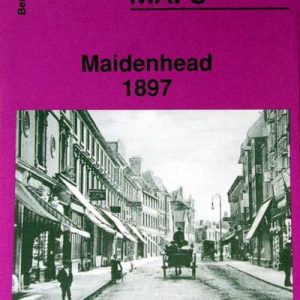
- Maps
Maidenhead, Old Ordnance Survey Map, 1897
- £3.00
- This map is part of a series of town maps with a scale of about 15 inches to the mile. They show not just the streets but virtually every house, track layouts of railways and tramways, factories, mills and docks.
- Read more
-
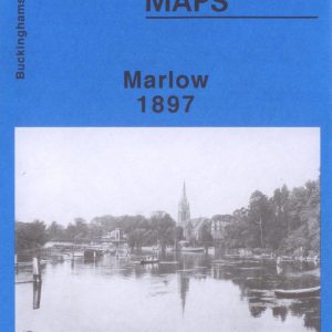
- Maps
Marlow, Old Ordnance Survey Map, 1897
- £3.00
- This map is part of a series of town maps with a scale of about 15 inches to the mile. They show not just the streets but virtually every house, track layouts of railways and tramways, factories, mills and docks.
- Read more
-
- Sale!
- Maps, Parish Registers - all denominations
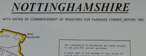
Nottinghamshire Parish Register Map (IHGS)
- Original price was: £2.25.£1.00Current price is: £1.00.
- Read more
-
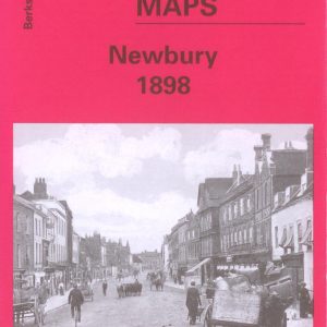
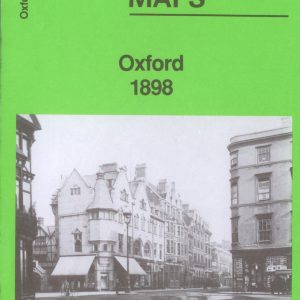
- Maps
Oxford, Old Ordnance Survey Map, 1898
- £3.00
- This map is part of a series of town maps with a scale of about 15 inches to the mile. They show not just the streets but virtually every house, track layouts of railways and tramways, factories, mills and docks.
- Read more
-
- Maps
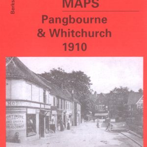
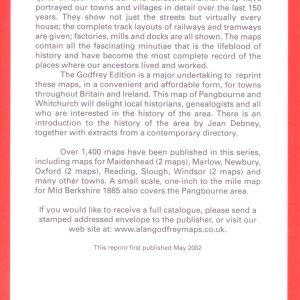
Pangbourne & Whitchurch, Old Ordnance Survey Map, 1910
- £3.50
- This map is part of a series of town maps with a scale of about 15 inches to the mile. They show not just the streets but virtually every house, track layouts of railways and tramways, factories, mills and docks.
- Read more
-
- Maps
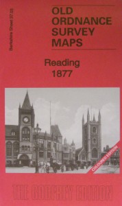
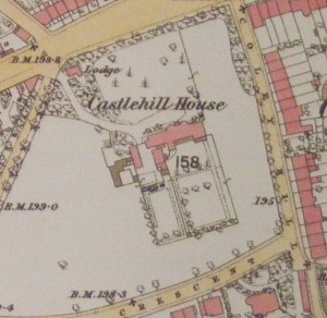
Reading, Old Ordnance Survey map, 1877, in colour
- £5.00
- New!! In colour. This map of Reading will be a good research tool for family and local historians and all who are interested in the area reproduced from the 1877 hand coloured map to a scale of about 15" to the mile.
- Read more
-
- Maps
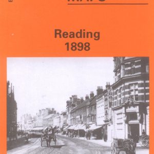
Reading, Old Ordnance Survey Map, 1898
- £3.50
- This map is part of a series of town maps with a scale of about 15 inches to the mile. They show not just the streets but virtually every house, track layouts of railways and tramways, factories, mills and docks.
- Read more
-
- Maps
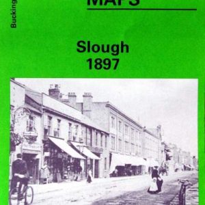
Slough, Old Ordnance Survey Map, 1897
- £3.50
- This map is part of a series of town maps with a scale of about 15 inches to the mile. They show not just the streets but virtually every house, track layouts of railways and tramways, factories, mills and docks.
- Read more
-
- Maps
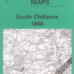
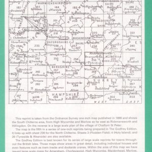
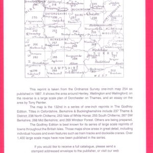
South Chilterns, One Inch Old Ordnance Survey Map, 1886
- £3.00
- This reprint of the One Inch Ordnance Survey map of 1886 shows the South Chiltons area from High Wycombe and Marlow as far east as Rickmansworth and Hillingdon with a large scale plan of Chalfont St Peter, and a history of the area by Elizabeth Lockwood.
- Read more
-
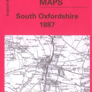
- Maps
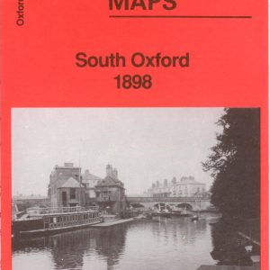
South Oxford, Old Ordnance Survey Map, 1898
- £3.50
- This map is part of a series of town maps with a scale of about 15 inches to the mile. They show not just the streets but virtually every house, track layouts of railways and tramways, factories, mills and docks.
- Read more
-
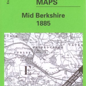
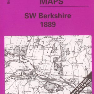
- Maps
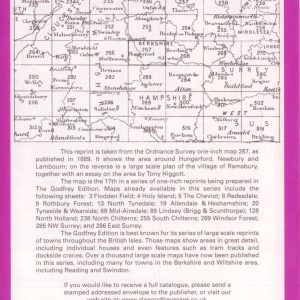
South West Berkshire, 1″ Old Ordnance Survey Map, 1889
- £3.00
- Reproduced from the One Inch Ordnance Survey map of 1889 and showing the area around Hungerford, Newbury, and Lambourn. With a large scale plan of the village of Ramsbury and an essay on the area by Tony Higgott.
- Read more
-
- Maps
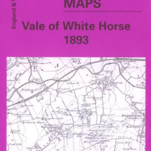
Vale of the White Horse, One Inch Old Ordnance Survey Map, 1893
- £3.00
- Reprinted from the One Inch Ordnance Survey map of 1893 and showing the area around Abingdon, Didcot and Wantage. On the reverse is a large scale map of Faringdon and an essay on the history of the area by Tony Higgott.
- Read more
-
- Books, Maps
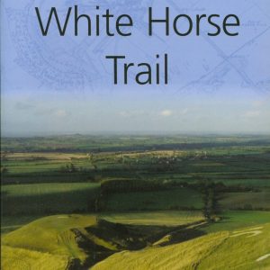
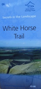
White Horse Trail
- £2.00
- Uffington White Horse is on the crest of White Horse Hill, which is the highest point in Oxfordshire.This leaflet describes a circular walk around White Horse Hill, about 5.5 miles.
- Read more
-
- Maps
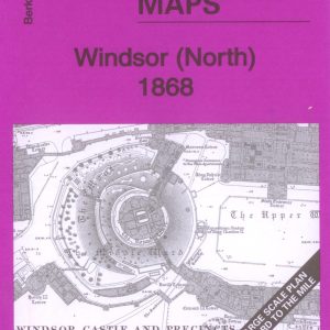
Windsor (North) Old Ordnance Survey Map 1868
- £3.00
- Large scale Town Map 15" to the mile.
- Read more
-
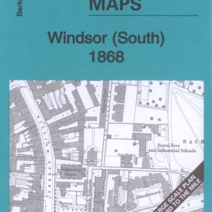
- Maps
Windsor (South) Old Ordnance Survey Map 1868
- £3.50
- Large Scale Town Map approx 15" to the mile.
- Read more
-
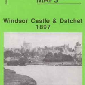
- Maps
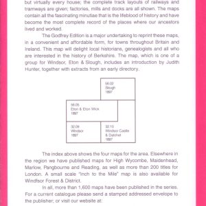
Windsor Castle & Datchet, Old Ordnance Survey Map, 1897
- £3.50
- This map is part of a series of town maps with a scale of about 15 inches to the mile. They show not just the streets but virtually every house, track layouts of railways and tramways, factories, mills and docks.
- Read more
-
- Maps
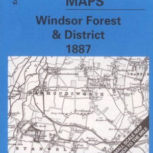
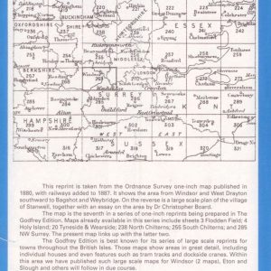
Windsor Forest & District, One Inch Old Ordnance Survey Map, 1887
- £3.50
- Reprinted from the One Inch Ordnance Survey map of 1880 and showing the area from Windsor and West Drayton southward to Bagshot and Weybridge. With large scale map of Stanwell together with an essay on the area by Dr Christopher Board.
- Read more
-
- Maps
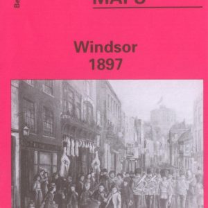
Windsor, Old Ordnance Survey Map, 1897
- £2.50
- This map is part of a series of town maps with a scale of about 15 inches to the mile. They show not just the streets but virtually every house, track layouts of railways and tramways, factories, mills and docks.
- Read more
-
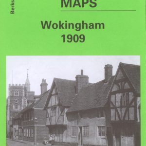
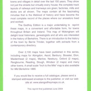
- Maps
Wokingham, Old Ordnance Survey Map, 1909
- £3.50
- This map is part of a series of town maps with a scale of about 15 inches to the mile. They show not just the streets but virtually every house, track layouts of railways and tramways, factories, mills and docks.
- Read more
-
- Out of StockSale!
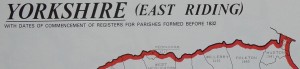
- Maps, Parish Registers - all denominations
Yorkshire (East Riding, Ainstey & City of York) Parish Register Map (IHGS)
- Original price was: £2.25.£1.00Current price is: £1.00.
- NEW LOWER PRICE
- Read more
-